The contents of this blog have now been moved to:
http://blogs.nasa.gov/cm/blog/airborne_science
Future posts will be added there.
Also, please follow us on twitter at:
twitter.com/nasa_airborne
Friday, April 22, 2011
Monday, March 21, 2011
Students Selected for 2011 NASA Student Airborne Research Program (SARP)
Thirty advanced undergraduate and early graduate students from across the United States have been selected to participate in the 2011 NASA Student Airborne Research Program (SARP).
SARP, now in its third year, is a unique summer internship program that enables students to acquire hands-on research experience in all aspects of an airborne scientific campaign. The thirty students will work in multi-disciplinary teams in three general research areas: atmospheric chemistry, evapotranspiration from agricultural crops in California, and ocean biology along the California coast. They will assist in the operation of instruments onboard the NASA DC-8 aircraft to sample atmospheric gases and to image land and water surfaces in multiple spectral bands. Along with airborne data collection, students will also participate in taking measurements at field sites.
Outstanding faculty, mentors, and staff are drawn from several universities and NASA centers as well as from NASA flight operations and engineering. Program faculty will present detailed information on their research. Faculty and mentors will then guide participants through instrument and flight preparations, data analysis, and interpretation. Students will give final presentations of their results and the conclusion of the program. In addition, several students will go on to present their results at the American Geophysical Union fall meeting in San Francisco.
SARP is managed by the National Suborbital Education and Research Center at the University of North Dakota with funding form the NASA Airborne Science Program. For more information and updates on SARP 2011, please visit www.nserc.und.edu/learning/SARP2011.html
SARP, now in its third year, is a unique summer internship program that enables students to acquire hands-on research experience in all aspects of an airborne scientific campaign. The thirty students will work in multi-disciplinary teams in three general research areas: atmospheric chemistry, evapotranspiration from agricultural crops in California, and ocean biology along the California coast. They will assist in the operation of instruments onboard the NASA DC-8 aircraft to sample atmospheric gases and to image land and water surfaces in multiple spectral bands. Along with airborne data collection, students will also participate in taking measurements at field sites.
Outstanding faculty, mentors, and staff are drawn from several universities and NASA centers as well as from NASA flight operations and engineering. Program faculty will present detailed information on their research. Faculty and mentors will then guide participants through instrument and flight preparations, data analysis, and interpretation. Students will give final presentations of their results and the conclusion of the program. In addition, several students will go on to present their results at the American Geophysical Union fall meeting in San Francisco.
SARP 2010 Video Summary (produced by J. Peterson)
SARP 2009 was featured in an NPR piece "Earth Science from the Sky: The Next Generation" by Jon Hamilton.
The 2011 SARP students hail from 29 universities and colleges in 21 states. The majors of the students in this interdisciplinary group cover a wide range of scientific, mathematical, and engineering disciplines. Students were competitively selected based on their outstanding academic performance, future career plans, ability to work in teams, and interest in Earth system science. One of the great strengths of SARP is that students from different disciplines learn from each other and work together toward common research goals. Students also form lasting personal and professional relationships that they will carry into their future careers.
Saturday, March 5, 2011
Glory Launch
All of the scientists, engineers, pilots, and crew onboard the NASA DC-8 and the NASA Airborne Science support staff on the ground were deeply saddened by the launch failure of the Glory satellite. For more information about the specifics of what went wrong, watch the NASA news conference. For information on what the loss of Glory means to climate science, see here.
The NASA DC-8 left its home base at the NASA Dryden Aircraft Operations Facility in California at 9:47PM PST.
 |
| Boarding the NASA DC-8 before takeoff (March 4, 2011 8PM) |
 |
| Inside the NASA DC-8 (March 4, 2011 8PM) |
The DC-8 flew 1800 miles south to 7.5N 120W (a spot over the Pacific Ocean 2800 miles off the coast of Panama) where it circled for approximately thirty minutes at 41,000 ft, waiting to track the launch at 2:09 AM PST.
 |
| NASA DC-8 flight track (red line). The DC-8 tracked Glory's launch while flying at 41,000 ft at 7.5S 120W |
Instruments installed on the DC-8 by the KTech Corporation first detected Glory approximately four minutes after launch and tracked it for ten additional minutes. The failure of the fairing (a protective cover) to separate approximately three minutes after launch was revealed in Glory’s unexpected trajectory.
Telemetry data collected by the NASA DC-8 and from other locations will be used to better understand what went wrong.
Thursday, March 3, 2011
NASA DC-8 to support Glory launch!
Check out the NASA Dryden coverage of the DC-8's support of the Glory launch early Friday morning!
@NASA_Airborne will be tweeting live from the NASA DC-8 over the Pacific Ocean!
@NASA_Airborne will be tweeting live from the NASA DC-8 over the Pacific Ocean!
 |
| NASA DC-8 parked at the Dryden Aircraft Operations Facility (March 3, 2011) |
Thursday, February 17, 2011
TWiLiTE concludes successful flights on ER-2
TWiLiTE (Tropospheric Wind Lidar Technology Experiment) successfully completed engineering testing today at the NASA Dryden Aircraft Operations Facility in Palmdale, CA.
 |
| The NASA ER-2 in flight |
The TWiLiTE instrument measures wind profiles through the lower atmosphere. During deployment, TWiLiTE operated for 17 hours while airborne on the NASA ER-2. The highlight of the deployment was a science flight from Palmdale to Denver on Valentine’s Day during which TWiLiTE took five hours of wind profile measurements.
After the ER-2 returned, instrument scientists from NASA’s Goddard Space Flight Center were literally jumping and yelling for joy in the hangar at Dryden when they took their first look at the data!
Wind profile data collected by TWiLiTE will be important for analyzing atmospheric dynamics, for weather predictions, and for understanding Earth's hydrological cycle. Data reduction and processing is now in progress. The data will also be compared with ground validation measurements to verify TWiLiTE’s performance.
 |
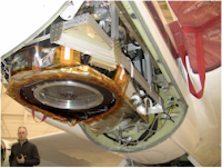
| TWiLiTE sits on its dolly in the hangar at Dryden Aircraft Operations Facility after its successful flights on the NASA ER-2 (Feb 17, 2011) |
 |
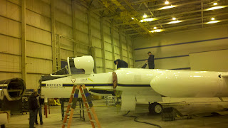
| Engineers work on the ER-2 after TWiLiTE is removed (Feb 17, 2011) |
The TWiLiTE instrument was developed with funding from the Earth Science Technology Office as a demonstration for the 3D-WINDS Global Wind Space Mission. ER-2 flight testing of TWiLiTE was provided by the NASA Airborne Instrument Technology Transfer program.
Subscribe to:
Comments (Atom)


